Community Corner
Irene's Path Veers Away from Tampa Bay Area
The storm could be a major hurricane by the time it strikes the Bahamas tonight or Wednesday, the National Hurricane Center says.

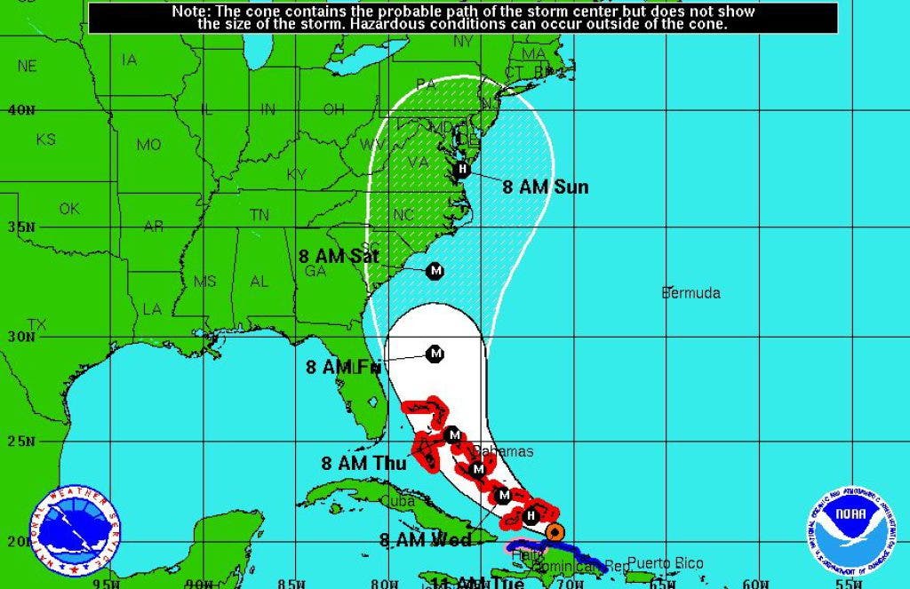
Hurricane Irene is expected to skirt Florida on Thursday and Friday as it heads up the East Coast, according to the latest forecast model from the National Hurricane Center in Miami.
The Tampa Bay area was placed in the five-day forecast cone on Monday morning. Newer forecasts from the National Weather Service have moved Irene's track farther east. Still, the Bay area could receive heavy rain and wind from the storm at the end of the week, with local seven-day forecasts currently calling for scattered thunderstorms and gusting wind on Thursday and Friday.
Irene, a Category 1 hurricane, is expected to slow down slightly and gather strength before moving into the Bahamas late Tuesday or early Wednesday, according to the National Hurricane Center. The storm has sustained winds of 90 mph and is currently creating a storm surge of up to 11 feet in the Caribbean islands.
Find out what's happening in Pinellas Beacheswith free, real-time updates from Patch.
Local emergency management officials encourage residents to stock up on supplies including water, ice, food, medicine and batteries before the storm makes landfall, and to be familiar with their evacuation zones.
Stay with Pinellas Beaches Patch for updates on Irene.
Find out what's happening in Pinellas Beacheswith free, real-time updates from Patch.
Get more local news delivered straight to your inbox. Sign up for free Patch newsletters and alerts.


